


A warning for a cyclone has been issued in the northern part of Australia for coastal towns ranging from Groote Eylandt Island to the border of Northern Territory and Queensland. The Australian Bureau of Meteorology has classified Tropical Cyclone Megan, formed in the Gulf of Carpentaria on Saturday, as a category 3 cyclone. Megan is predicted to reach land on Monday, but has already caused strong winds and significant precipitation in some regions since the weekend. On Sunday, Groote Eylandt was isolated due to over 400mm of rainfall within a 24-hour period.
It is possible that Megan may become a category 4 hurricane before reaching land, bringing the potential for winds up to 125km/h that could cause damage. Megan is the fifth named storm in Australia this season, which is less than the usual average of 10 at this point in the year.
Finland has had a relatively mild start to March, but it turned colder over the weekend, with a snowstorm bringing up to 10-15cm of snow and freezing temperatures to parts of the country on Sunday. The low temperatures look set to continue over the next few days, with minimum temperatures as low as -16C expected in Tampere, around 10C below the seasonal average for this time of year. Temperatures are expected to return to around or just above average again by the end of the week.
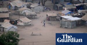
As a response to a severe heatwave that is expected to last for the next two weeks, South Sudan will be closing all schools starting Monday indefinitely. Temperatures are predicted to reach 41-45C, with some areas experiencing even higher temperatures of up to 50C. Overnight temperatures are not expected to drop below 27-28C. The capital, Juba, is expected to have daily temperatures of 40-42C this week.
Source: theguardian.com