On Tuesday, Hurricane Otis rapidly intensified from a tropical storm to a highly hazardous Category 5 hurricane as it neared the southern Pacific coast of Mexico. The president advised citizens to take cover and find shelter.
The hurricane was predicted to hit the Acapulco resort on Wednesday morning and the US National Hurricane Center issued a warning that it will result in severe damage.
A dire situation is unfolding in southern Mexico tonight as Hurricane Otis rapidly strengthens and moves towards the coast, according to a forecaster from the National Hurricane Center on Tuesday evening.
The weather service stated that the current situation in the Acapulco metropolitan area is very grave, as the powerful hurricane is expected to pass near or directly over the city on Wednesday. This level of intensity has not been seen in this part of Mexico before.
The President of Mexico, Andrés Manuel López Obrador, used the social media platform X, also known as Twitter, to advise individuals to seek refuge in shelters and avoid areas near bodies of water and steep terrain. He also urged people to remain vigilant and not become overly confident.
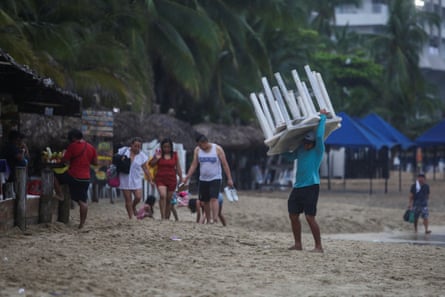
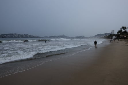
As rain started to fall and winds increased, tourists were forced to leave the beach while residents of Acapulco, a city with a population of over a million, rushed back to their homes.

The government of Guerrero state stated that they were getting ready to open 396 shelters in case families were forced to leave their homes due to wind damage or rising flood waters.
More than 8,000 soldiers and sailors from Mexico’s armed forces were sent to the region with specialized equipment to assist in rescue efforts. The port of Acapulco, which houses approximately 300 fishing vessels, was closed by authorities.

It was anticipated that Otis would bring heavy precipitation of 5 to 13 to 25cm (10in) in Guerrero, with the potential for up to 38cm in certain regions. This increased the potential for mudslides and flash floods due to the steep mountainous landscape of Guerrero.
The National Hurricane Center of the United States reported that Otis had winds reaching a maximum speed of 260kph (160mph) on Tuesday evening. The hurricane was located approximately 90km (55 miles) south-southeast of Acapulco and was traveling at a speed of 15kph in a north-northwest direction.

According to the forecast, Otis was predicted to maintain its status as a Category 5 hurricane until it reaches land. However, once it encounters the elevated land of Mexico, it is anticipated to quickly lose strength. The storm is expected to then disperse over southern Mexico by Wednesday evening.
A warning for a hurricane was issued from Punta Maldonado to Zihuatanejo, and a watch for a hurricane is currently in effect from Lagunas de Chacahua to Punta Maldonado.
At the moment, in the Atlantic Ocean, Hurricane Tammy is still heading northeast and has wind speeds of 120kph. It previously passed through the Lesser Antilles during the weekend.
According to the US National Hurricane Center, the storm is predicted to lose strength by Thursday.
Source: theguardian.com


