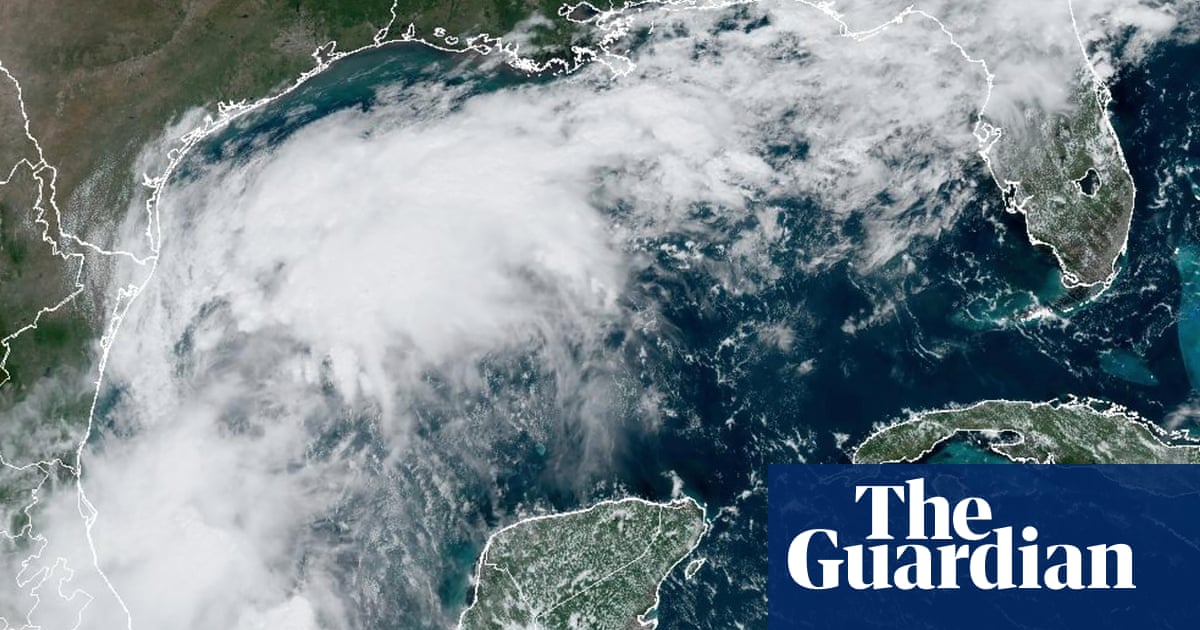
Francine could soon be the next to be ticked off the list of Atlantic hurricane storm names this week. On Friday, a broad area of low pressure emerged in the Gulf of Mexico, designated as Invest 91L. An “invest” – a shorthand for “investigative area” – refers to a region of atmospheric disturbance, characterised by low pressure and thunderstorms, and is closely monitored for its potential to evolve into a tropical cyclone.
Invest 91L is anticipated to encounter more favourable environmental conditions as it progresses northward over the coming days, meandering along the eastern coasts of Mexico and Texas. The National Hurricane Center has now labelled this as a potential tropical cyclone, and it is expected to reach hurricane status before reaching the Gulf coast of the US. It advises that hurricane and storm surge watches will probably be issued on Monday for coastal parts of Texas and Louisiana, with the impacts expected to be felt from Tuesday night.
While wind speeds may not be the most striking feature, the associated rainfall could make for some challenging conditions. As Invest 91L advances inland, eastern Texas and Louisiana could experience intense precipitation on Thursday, with some areas receiving up to 100mm of rain within six hours.
South America is poised to experience a significant rise in temperatures later this week, with daily highs soaring up to the mid- to high-30s Celsius. Both Brazil and Paraguay are expected to witness temperatures approximately 10C above the seasonal average, with Rio de Janeiro reaching 36C, and Asunción in Paraguay peaking at 37C on Wednesday. However, Argentina will take the top spot in the most extreme climatic deviation, with Córdoba anticipated to approach 35C on Tuesday, 13C above the norm.
In contrast, central Europe will experience a dramatic temperature plunge after the hottest summer on record. An influx of Arctic air will sweep across the UK and central Europe into the Mediterranean starting on Tuesday, resulting in daytime maximum temperatures plummeting more than 10C below the seasonal average.
after newsletter promotion
Daily highs in Croatia, the Czech Republic and Slovenia, among others, will struggle to hit double digits on Thursday and Friday. Innsbruck in Austria looks likely to endure the most pronounced chill, experiencing temperatures about 13C below the norm and going from a predicted maximum daytime temperature of 23C on Wednesday, to no more than 8C by Friday.
Source: theguardian.com


